01 · MEASURED, MODERNThe shape of the ground
USGS 3DEP bare-earth elevation, sampled on a 257 × 257 grid at approximately 12 m spacing. Heights and horizontal distances use meters, with no vertical exaggeration. Modern cuts, roads and later landscape alterations may remain in the data.
USGS 3DEP elevation service ↗Retrieved October 22, 2026 · 39.794–39.822° N, 77.261–77.223° W
02 · HISTORICAL REFERENCERoads, farms & defensive ground
Farm lanes, orchards, woodlots, Emmitsburg Road and selected physical fence runs are approximately traced from the Warren survey. Land-cover colors are reconstructed; they do not denote property ownership or prove enclosure. The 1868–69 postbattle survey is interpreted alongside NPS research and Bachelder’s 1863 perspective. A local four-point map fit has a 24 m control residual; this is an approximate alignment, not survey-grade 1863 geography.
Warren survey · Library of Congress ↗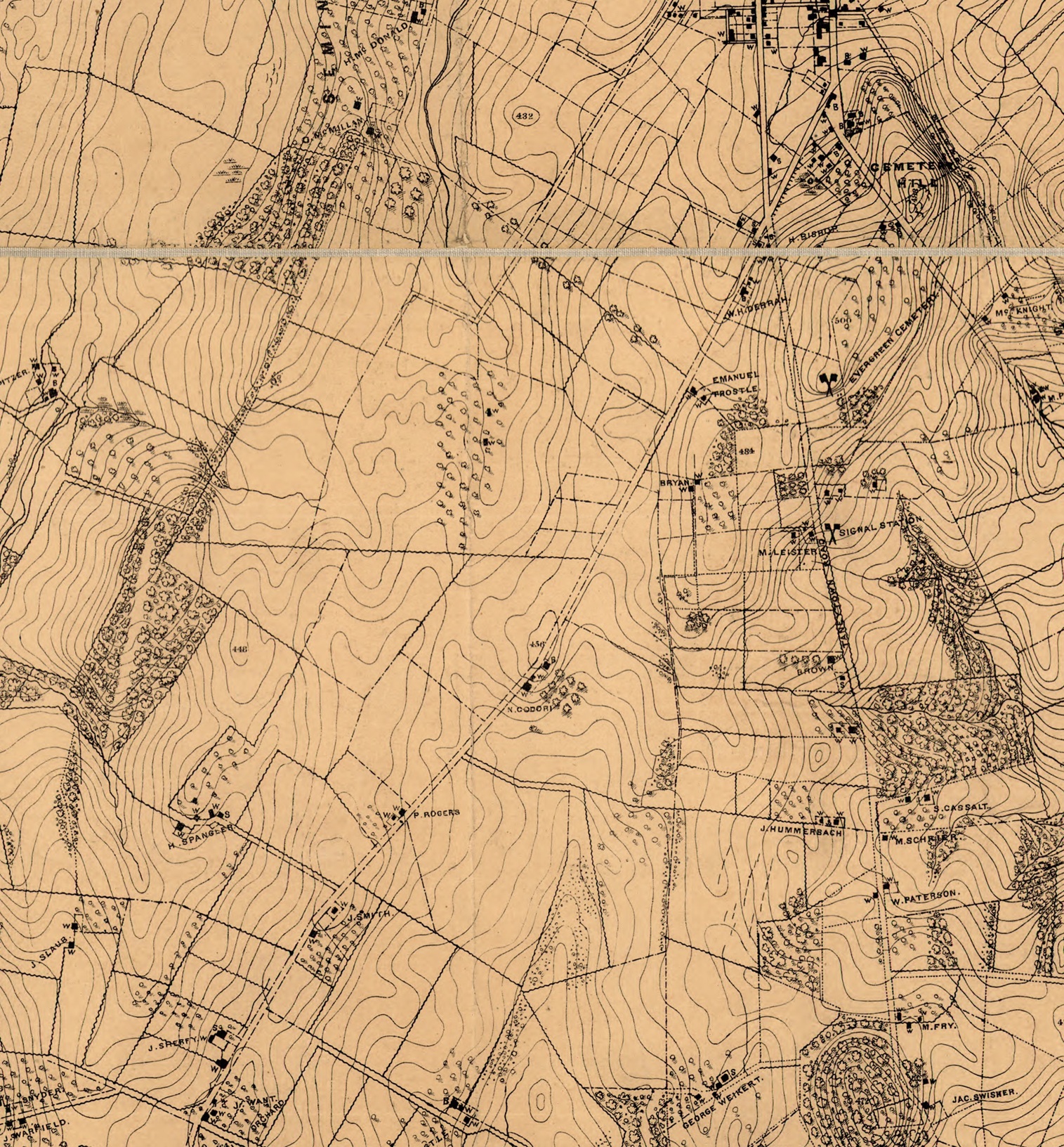 View the map used for tracing ↗NPS historical base-map study ↗
03 · HISTORICAL CONTEXT
The assault sector
The assembly symbols are approximate brigade or regimental locators registered against farm landmarks, with schematic lengths. They are not physical formation footprints, strength measurements, or a complete roster. Colors identify armies; no individual troop deployment is implied. The source’s later maps combine actions across a time interval and cannot serve as exact simultaneous snapshots.
American Battlefield Trust · phase-map series ↗The study frames the terrain crossed in the July 3 assault. Seminary Ridge is a broad reference area, not a precise starting position for every formation. The attack included troops from Pickett’s, Pettigrew’s and Trimble’s commands.
NPS Pickett’s Charge guide ↗1876 battlefield maps · Bachelder / Warren ↗
04 · ILLUSTRATIVE RECONSTRUCTIONFences are not parcel boundaries
Warren’s legend identifies stone walls with continuous dots, post-and-rail fences with dots and dashes, and worm fences with zigzags. Only identified physical-fence symbols produce 3D fencing. Smooth contours, ownership labels and land-cover boundaries do not. The two east-ridge rail-to-stone transitions follow visible changes from zigzags to continuous dots. Their junctions and road-verge endpoints are now connected; color changes alone never produce a fence.
 Inspect the original fence legend ↗
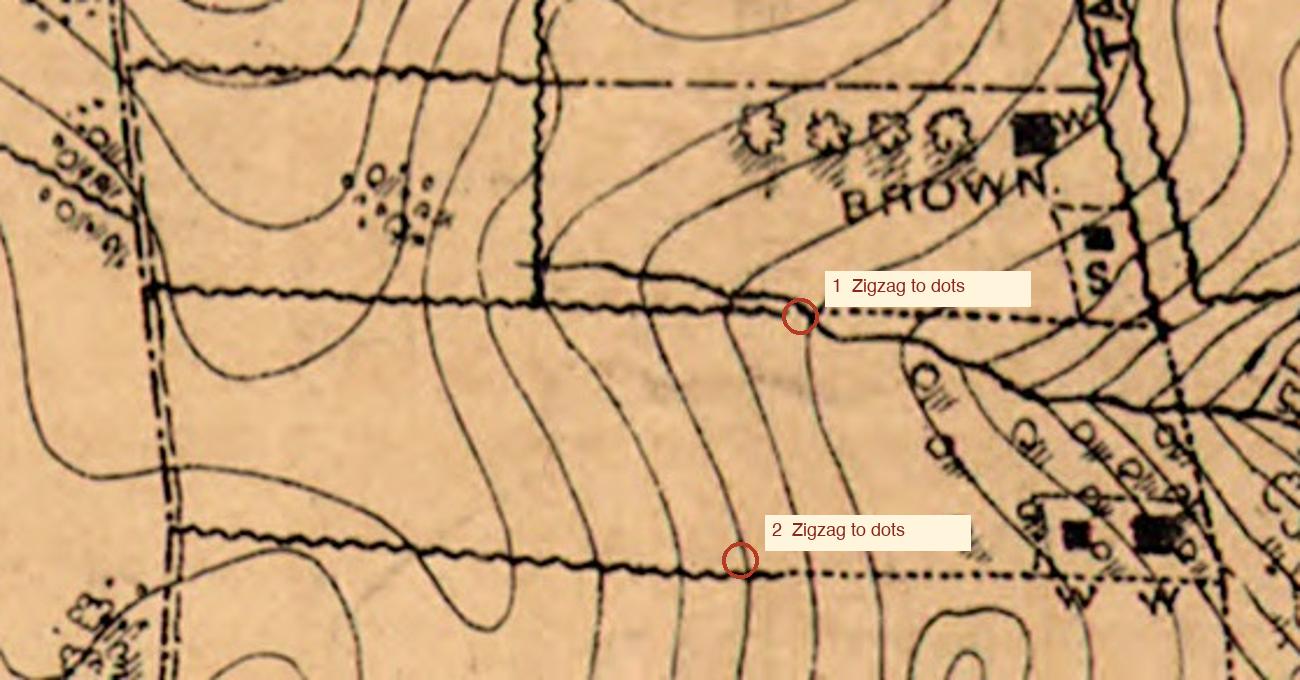 Inspect the material changes ↗
How the fences are built
Worm fencing uses overlapping split rails in a broad zigzag, with slender crossed stakes and a top rider. Post-and-rail runs have five rails; low stone walls use irregular, closely fitted stones. NPS research supports 10–12-foot worm-fence rails and commonly four or five rails in post-and-rail fencing. The chosen heights, bracing pattern, weathering and individual rails are reconstructed, not measured from each 1863 fence.
What remains provisional
Bryan’s cottage silhouette follows an 1863 photograph; Codori uses the documented low English-style barn, and Bliss remains burned ruins. Building dimensions, ancillary structures, gardens, orchard spacing and density, exact tree positions, crop assignments, rail details and gate openings are reconstructed. Postbattle map features may differ from July 1863. The south end of the Angle stone wall is estimated from the NPS account of its roughly 260-yard extent; that material interface is provisional. Access openings follow farm tracks, with reconstructed widths. Some traces continue into woods beyond the detailed reconstruction. This is not an inventory of intact panels at a precise moment in the battle. The copse is not an exact tree inventory.
Bryan house · July 1863 photograph ↗NPS cultural landscape inventory · historic orchards ↗U.S. Army history · roadside fences ↗NPS · Abraham Brian farm ↗Only the Codori, Bryan and Bliss farm groups are developed here. Orchard existence is documented; individual trees, spacing and density are reconstructed. Peripheral farm groups await further work. Troops and battle playback have not been added.